
Articles tagged "Google Earth"
You can now go back in time using Google Earth for web
Google Earth's biggest change in four years and how it links to IB DP Geography.
Google, making the biggest change since 2017, has added the ability to go back in time to the web based version of Google Earth. With 'Timelapse in Google Earth' you can look back at the past 37 years of satellite imagery in some locations. This feature was a much loved tool on the desktop version of Google Earth and now users can make use of it on (in my opinion) Google Earth's flagship version - Google Earth on web.
Looking back in time anywhere
To explore Timelapse in Google Earth, go to g.co/Timelapse - you can use the handy search bar to choose any place on the planet where you want to experience the passing of time.
If you are already in Google Earth on web you can click on the ship's wheel on the left hand navigation menu. This is Voyager - Google Earth's storytelling platform. Then choose 'Timelapse in Google Earth'.
Looking back in time at some suggested locations
Google Earth has curated some locations and stories to check out →
Changing Forests - gives you 11 locations - such as soybean farming [Bolivia], cattle ranching [Bolivia] and Palm Oil Production [Indonesia].
- Consider how you could link these locations to "Environmental issues linked with the global shift of industry: food production systems for global agribusiness" from Unit 6 of the IB DP Geography guide.
Fragile Beauty - gives you 8 locations - such as rivers meandering [Bolivia] and changing coastlines [US].
- Consider how you could link these locations to "River processes of erosion, transportation and deposition and spatial and temporal factors influencing their operation" from the Freshwater geographic theme of the IB DP Geography guide or "The characteristics and formation of coastal landforms of erosion and deposition, including wave cut platform, cliff, stack, spit and beaches" from the Oceans and coastal margins geographic theme.
Sources of Energy - gives you 11 locations - such as coal mining [US], solar farms [China] and wind farms [US].
- Consider how you could link these locations to "An overview of global patterns and trends in the availability and consumption of: energy, including the relative and changing importance of hydrocarbons, nuclear power, renewables, new sources of modern energy" from Unit 3 of the IB DP Geography guide.
Warming Planet - gives you 10 locations - such as the Columbia Glacier [US] and Aral Sea [Kazakhstan and Uzbekistan].
- Consider how you could link these locations to "Climate change and the hydrosphere, atmosphere and biosphere, including: water stored in ice and oceans, and changing sea levels and changes to agriculture, including crop yields, limits of cultivation, soil erosion" from Unit 2 of the IB DP Geography guide.
Urban Expansion - gives you 10 suggestions - such as Las Vegas [US], Shanghai [China] and Dubai [Dubai]
- Consider how you could link these locations to "One case study of a contemporary megacity experiencing rapid growth" from Unit 1 of the IB DP Geography guide.
Google has also uploaded more than 800 Timelapse videos in both 2D and 3D for public use at g.co/TimelapseVideos. These videos are available for download. You can select any video you want as a ready-to-use MP4 video or sit back and watch the videos on YouTube.
In collaboration with their partners, Google will update Google Earth annually with new timelapse imagery throughout the next decade.
Read more →
Google - The Keyword - Time flies in Google Earth’s biggest update in years [15 April 2021]
Google - The Keyword - 3 ways Liza Goldberg uses Timelapse to explore the planet [15 April 2021]
Weekly post #20 - Google Earth, Anki flashcards and the end of Flash.
Four things to check out.
Adobe Flash Player is dead!

Adobe stopped supporting Flash Player beginning December 31, 2020, as they previously announced in July 2017.
In addition, to help secure users’ systems, Adobe blocked Flash content from running in Flash Player beginning January 12, 2021. Adobe strongly recommends all users immediately uninstall Flash Player to help protect their systems.
If you believe that some of the teaching resources you reply upon are Flash based - now would be the time to explore alternatives!
Read more here → adobe.com - Adobe Flash Player EOL General Information Page
Google Earth skills progression
Recently the Individuals and Societies department have been integrating Google Earth Projects into various units. Year 9 students are using Google Earth to design and document a flight from Southampton to Cape Town in 1937. Some Year 11 students will be using Google Earth to present their knowledge and understanding of glacial landforms.
The Google Earth skills progression that has been developed to support the integrations can be found in the Campus des Nations Digital Toolbox.
Ever wondered about Google Earth imagery? This video does a good job in explain it all.
Smart compose and spelling autocorrect available when adding comments in Google Docs

Smart compose and spelling autocorrect are now available when adding comments in Google Docs. These features help you compose comments quickly and with confidence by reducing the chance of spelling and grammatical errors and suggesting relevant contextual phrases.
Read more here → Google Workspace Updates Smart compose and spelling autocorrect available when adding comments in Google Docs
Anki flashcards are part of an 'active recall' and 'spaced repetition' revision approach
Anki is a free to install (Windows and Mac) application that is used to make and review flashcards. The application, which is popular with university medical and law students, is based upon enabling spaced repetition. As a user reviews a deck they indicate how easy or hard they found the content. This will then determine how soon after the user sees that card again.
Read more here → Using Anki flashcards as an IB DP Diploma student
Google Earth on web digital skills progression

This is an initial attempt at a 'Google Earth on Web digital skills progression'.
The skills are not intended to be sequential. It is more about identifying the skills we expect students to join the secondary school with, the skills we will develop with them in the first three years of secondary school and then what we expect them to have mastered by the end of their fifth year.
Feedback gratefully received - Ecolint staff via email, others via Twitter @richardallaway or @digitaltech_edu.
Foundation [skills that can be expected from students joining Year 7]
| Skill | Hint |
|---|---|
| Look (Search) for a specific place | Using the search tool on the left hand side toolbar. |
| Turn on latitude & longitude gridlines | Left hand side toolbar → Map Style → Turn on Gridlines. |
| Move around / Zoom in and out | Try using both a mouse/trackpad/touchscreen and the keyboard shortcuts (cursor keys / Page Up and Page Down / Fn + cursor keys). |
| Change view from 2D (from above) to 3D | Using either the button in the bottom right hand corner of the screen or the keyboard shortcut. |
Year 7 to 9 [all student by the end of Year 9]
| Skill | Hint |
|---|---|
| Show (and use) keyboard shortcuts | Shift + ? |
| Explore using Voyager and Layers | Accessed from the left hand toolbar. |
| Measure distances and area | Use the tool from the left hand toolbar. |
| Share a location with someone (using the URL) | Copy the URL from the Chrome omnibox and then share via email or similar. |
| Use keyboard shortcut to: Rotate the 3D scene + Rotate the camera | Easiest way to remember is to check the keyboard shortcut aide memoire with Shift + ? |
| Use keyboard shortcut to: return to north-facing view and top down view | Easiest way to remember is to check the keyboard shortcut aide memoire with Shift + ? |
| Turn on and off 3D imagery | This can useful to speed up a slow connection and see more recent imagery. |
| Explore locations using Google Street View with Google Earth | Drag Pegman from the tools in the bottom left hand corner of the screen onto the map - where the map turns blue. |
| Use Google Earth on a tablet or mobile device | The experience on tablet/mobile should be very similar to use on a laptop/desktop. Projects can not be created/edited on tablets/mobile. |
| Create a new Google Earth Project (with an appropriate name) | Start at the Projects button in the left hand toolbar. |
| Add a placemark (location) to a Project - from a search | Search for a location and then click on 'Add to Project' from the knowledge card. |
| Add a placemark (location) to a Project - using the 'Add placemark' button | Bottom left hand corner of the screen. |
| Share a Project with a viewer | Left hand side toolbar → Projects → New Project |
| Open and explore a Project produced by someone else | Shared via Google Drive or a link in an email / on a website. |
| Rearrange the order of features within a Project | Open the Project → Edit Project (Pen icon) → hover over a placemark and then click on and drag the two horizontal lines. |
| Change the name of a placemark | Open the Project → Edit Project (Pen icon) → hover over a placemark → Edit feature (Pen icon). |
| Add images and video clips to a placemark in a Project | The top box when editing a placemark. |
| Add and format a small or large info box to a placemark | Possible when editing a placemark. |
| Change/format a placemark icon | Possible when editing a placemark. |
| 'Capture this view' to be displayed when a placemark is visited | When editing a placemark - set the scene you want associated - then click 'Capture this view'. |
| Add Google Street View / Photospheres to a Project | When editing a placemark - set the scene you want associated - then click 'Capture this view'. |
Mastery [most students by the end of Year 11]
| Change units of measurement / Latitude & Longitude formatting | Left hand side toolbar → Settings. |
| Interpret the altitude and coordinates of the current view | Look at the bottom right hand corner of the screen. |
| Draw a line or shape (to be added to a Project) | Useful for highlighting an area or showing a path/flow. |
| Add a 'Fullscreen slide' to add structure to a Project | Useful for adding structure to a project. Edit a placemark → New Feature. |
| Collaborate with others to produce a Project | Click on a Project and then look for the 'Sharing' icon at the top of the pane. |
| Present (to an audience) using a Google Earth Project | Click on a Project → Present. |
| Duplicate a Project | Click on a Project → click on the three dots → Copy Project. |
Weekly post #17 – Google Sites, Earth, Meet and the Magellan-Elcano circumnavigation
Four things to check out
Customize text style and appearance in Google Sites

Those of you using Google Sites can now adjust text size, color, font, spacing, and more while typing in a text box. This significantly expands control over how individual words, paragraphs, pages, and sections look.
In 2021, Google will add the ability to create themes, which will allow users to easily set fonts, colors, and styles across your whole site.
Read more here → Customize text style and appearance in Google Sites
Google Earth in the Classroom
Worth 7 minutes of anybody's time! Google Earth doesn't just have to live in the Individuals and Societies classrooms. Any teacher who is interested in integrating Google Earth (or Maps) into their lessons - please get in contact!
Google Arts & Culture - The First Journey Around The World

Google Arts & Culture, the Spanish Ministry of Culture and the Spanish National Commission of the First World Tour have released a new project → “The First Journey around the World” which explores the details of the Magellan-Elcano circumnavigation.
In 1519, an expedition commanded by Ferdinand Magellan set sail from the port of Seville, Spain. The approximately 245 crew members aboard the five ships went in search of a new western route to the Maluku Islands (formerly the Moluccas or Spice Islands) in Indonesia. The voyage ended three years later, with the return of a single ship captained by Juan Sebastián Elcano. He and the 17 survivors became the first people to circumnavigate the globe in a single expedition.
You can dive into historical documents and maps, see where the expedition made landfall, take a virtual tour of a replica of the Nao Victoria, the only ship that returned to Seville, or discover the spices of animals encountered during the expedition.
“The First Journey Around the World” is available to everyone through the Google Arts & Culture site and via its iOS and Android apps.
Some Google Meet settings are now “sticky”

Google has changing the behavior of some Google Meet settings for G Suite for Education and Enterprise for Education customers. Specifically, certain settings are now “sticky.” This means that if you turn them on or off during a meeting, they will be saved for any future meetings that use the same meeting code.
This change will apply to these settings:
- Quick access
- Prevent students from sharing their screen
- Prevent students from sending chat messages
Read more here → Some Google Meet settings now “sticky” for Education users
Four video tutorials to get you started with Google Earth Projects
Produced for 'redevelopment' of my Imperial Airways to Cape Town lesson.
Creating a Project
Adding a placemark to a Project
Using the Measure Tool
Formatting a Placemark
Gridlines in Google Earth - lesson updated
With the announcement that gridlines are available in Google Earth for Chrome it would seem time to update a rather old geographyalltheway.com lesson to make use of this new feature.
"You can turn gridlines on and off in the Map Style panel, and they’ll appear in either decimal degrees or degrees, minutes and seconds, depending on the format you’ve chosen in Settings. Gridlines are available on Google Earth for Chrome, iOS and Android." Source
As Google Earth for Chrome evolves I will be adding new/redeveloped resources to geographyalltheway.com.
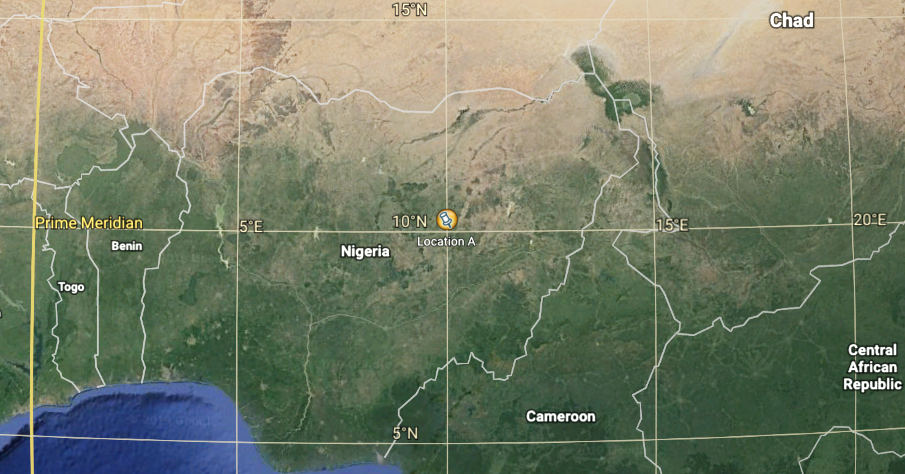
What is the latitude and longitude of these placemarks? is a straightforward resource that has students change some of the settings of Google Earth for Chrome, import a kml file of locations and then work out their latitude and longitude. The latitude and longitude of the placemarks can be entered into a Google Forms quiz for feedback.
If there are any other geographyalltheway.com resources that use Google Earth that you would like to see evolved to use Google Earth for Chrome - please let me know.
A line around the world
This piece of digital technology goodness starts with a bit of a story. Recently, while busy ‘networking’ at the Practical Pedagogies Conference in Cologne, I discussed a set of lessons with Matt Podbury, of geographypods.com fame, that he was developing.
The set of lessons were based upon the journey you would take if you left your classroom and travelled north until you reached the North Pole. Then travelled south until you reached the South Pole along the line of longitude that is ‘opposite’ to the one you started on. Then north from the South Pole back to your starting location. Matt’s ‘Over the Horizon’ lesson resources can be found here.
Matt was looking for a tool that would draw the necessary journey line upon Google Earth and was struggling to find something suitable. I explained that during the summer I had the good fortune of being invited to attend the biennial ‘Google Earth Education Experts’ meetup in Mountain View, San Francisco where I had met somebody that I knew would be able to help.
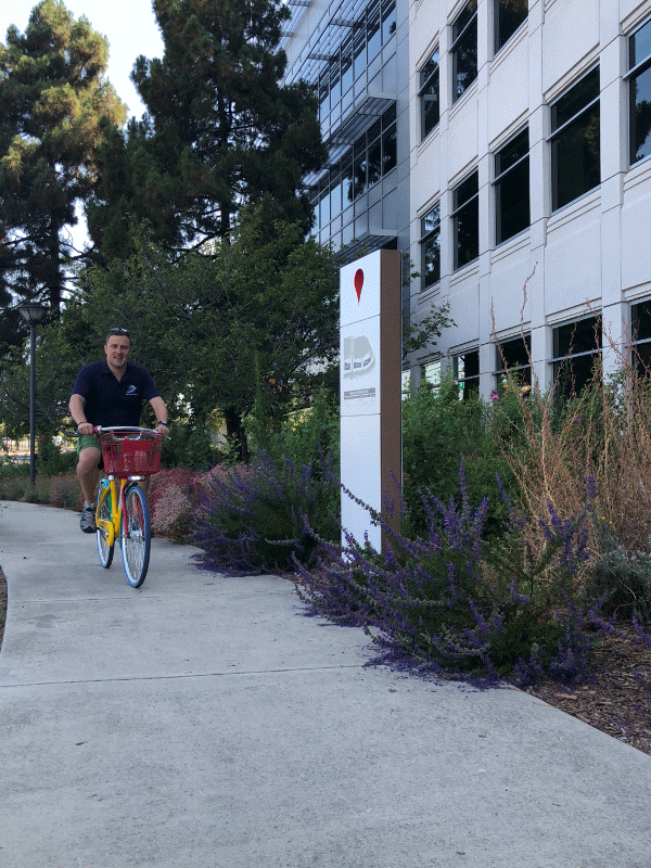
Enjoying myself at the Google Offices in Mountain View
Drawing the line
Josh Williams teaches Geography in Austin, Texas and is responsible for the website getech.com. Josh is a ‘Google Earth Education Expert’ and legend in the use of kml (Keyhole Markup Language) and that is why I reached out to him via Twitter to see if he had a solution.
Josh came back (really quickly) with a solution:
Not hard using text editor. 3 paths 1 path point to 90N --> 2 path 90N to 90S with antipode lng --> 3 path 90S to point lat (org. Lng). ex kml: https://t.co/xZVs8qSOz9 (open in text editor...notes in kml.
— jwilliams (@geteach) November 4, 2018
When my limited understanding failed me, Josh was kind enough to produce a screencast that explains how to edit the original file and make it work for any location you want.
Matt now has a solution for this set of lessons and I have an even greater respect for Josh’s skills. The screencast should allow teachers to be able to create the line if they wished to do the same lesson with their students. I also feel that there are opportunities for students to produce the lines themselves - maybe working with the maths or computer science departments to understand the process, the structure of the code in the kml file and the maths of lines of longitude.
Practical Pedagogies 2018 - Engaging older students with Google Geo Tools
I had the pleasure to attend the biennial Practical Pedagogies conference hosted by St. George's International School Cologne, Germany.
The focus of Practical Pedagogies is ‘REAL training for REAL classroom teachers’. I hope the session I presented upon ‘Engaging older students with Google Geo Tools’ was useful for the 20 or so ‘real’ teachers who attended.
The slidedeck can be found below:
If you have any question about any of the content - please get in contact.